

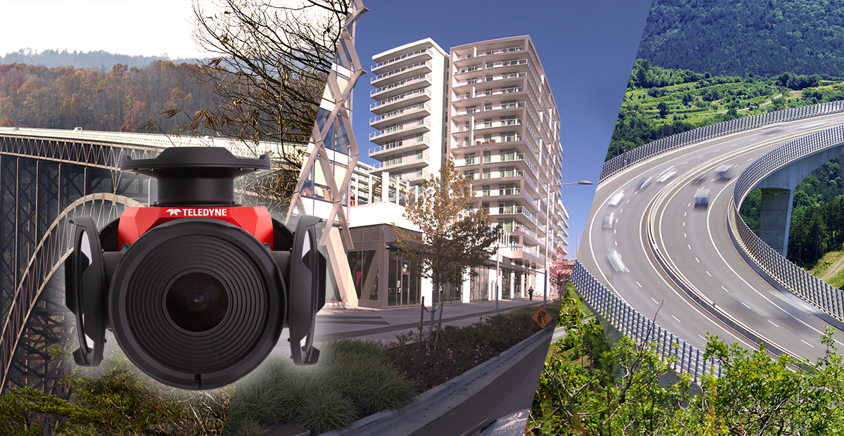
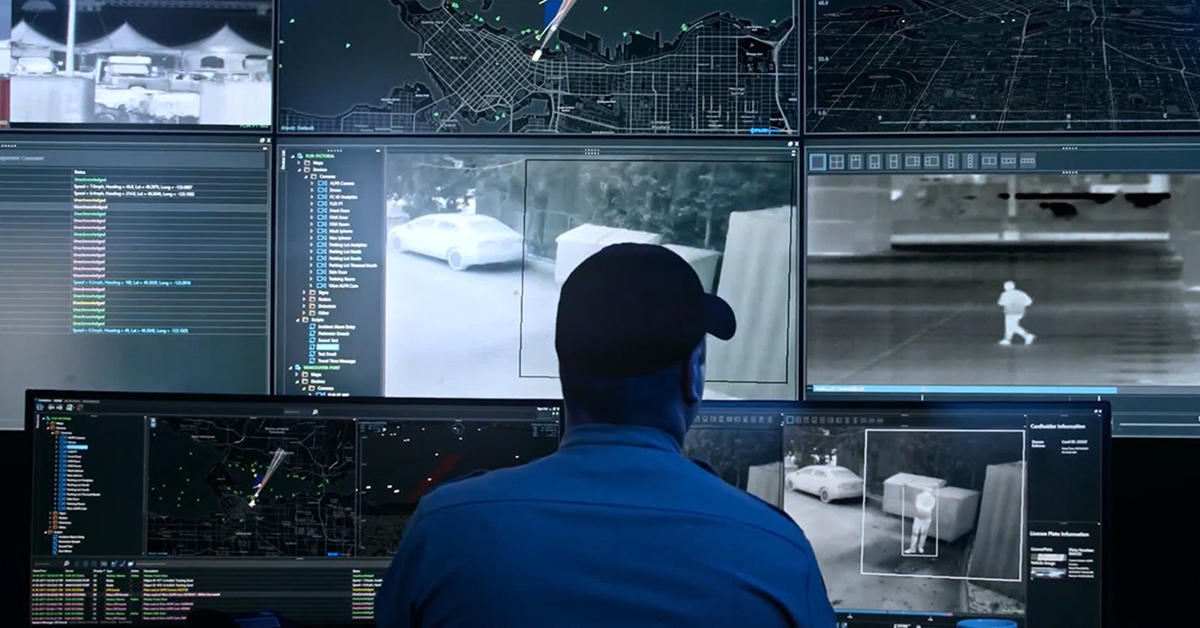
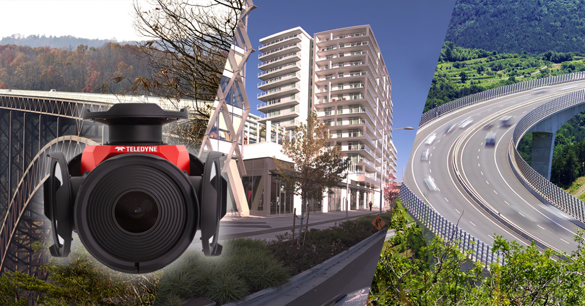
Beyond Resolution: What Really Makes a Camera System Work for Mobile Mapping
More pixels are nice. However, it is just as important to have precision, reliability, and accurate data at the right moment.
We’ve all heard: “We need a higher-resolution camera.”
More pixels do help, but in mobile mapping, that’s just one piece of a much bigger picture.
Whether you're capturing city infrastructure, inspecting roads, or managing asset inventories, the decisions you make downstream rely on the quality of the image data. This is not just how sharp the image is, but how usable, accurate, and synchronized it is.
After years of working with system integrators, engineers, and field teams building mobile mapping platforms, here’s what we’ve learned: It’s not just about resolution. It’s about how well the entire imaging system performs in the real world.
Let’s talk image quality (It’s not the same as resolution)
You can have all the megapixels in the world, but if your image is soft, overexposed, or lacks detail in the shadows, it won’t give you much to work with.
In mobile mapping, image quality means:
- Sharpness — to clearly capture alphanumeric markers, road signs, or small features
- Dynamic range — to preserve detail in both bright skies and shadowed curbs
- Color accuracy — to improve segmentation and classification by AI and machine vision systems
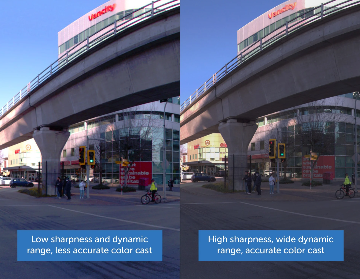
Compare the signboard logos, traffic light edges, and building shadows: the right side shows sharper details, balanced exposure, and more natural colors—critical for accurate AI segmentation and mapping
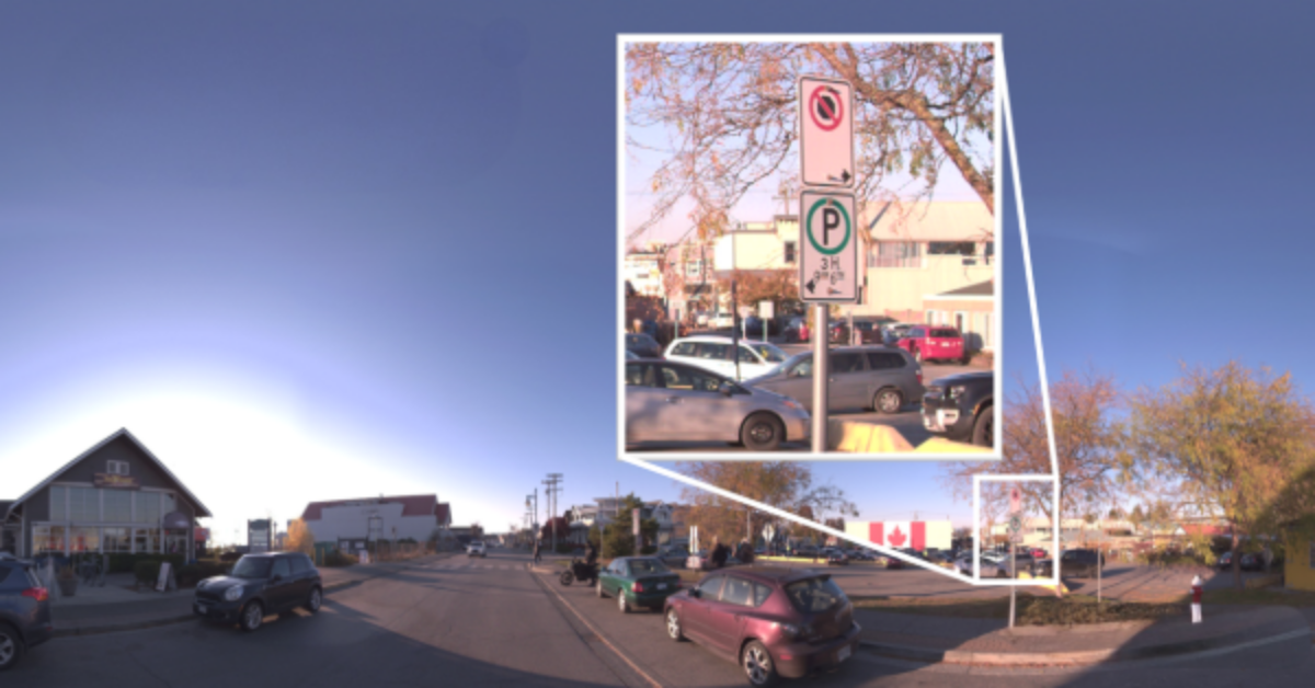
This is what makes computer vision effective. Whether you're identifying roadside assets or evaluating road surface conditions, both your computer vision AI algorithms and the people reviewing the results depend on clean, consistent input. Resolution alone won’t solve everything. This is especially true when your data needs to line up precisely with other sensor outputs. That’s where spatial accuracy comes in.
Accuracy isn’t just the job of GPS. It starts at the lens
It’s easy to assume your GPS or IMU handles all geospatial positioning. However, if your camera isn’t capturing geometrically correct images, everything downstream (LiDAR fusion, color overlays, GIS alignment) starts to drift.
Cameras must be properly calibrated. Lens distortion needs to be modeled and corrected, and camera intrinsics matter more than most people realize.
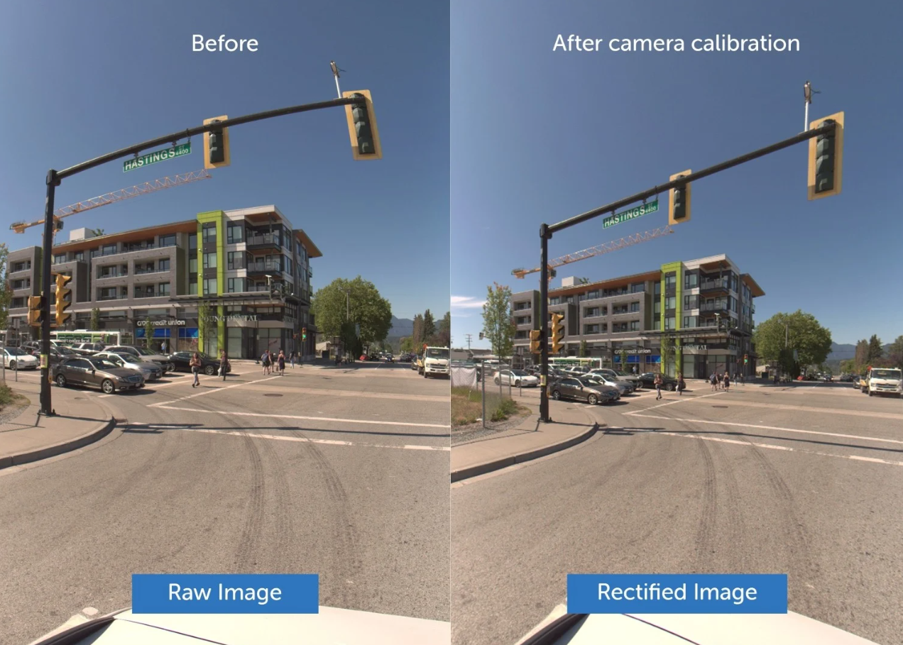
Observe the traffic light pole and building edges: in the raw image, lens distortion causes visible curvature. After calibration, straight lines are restored—essential for accurate alignment with LiDAR and spatial data in mobile mapping.
We’ve seen teams working with millimeter-accurate point clouds struggle with mismatched imagery. Sometimes the issue isn’t the GPS. It’s the lack of proper camera calibration to correct lens distortion and maintain geometric consistency.
Of course, accurate positioning only works if your timing is in sync. That brings us to one of the most overlooked and critical factors in mobile mapping.
Trigger timing: Unseen, but crucial
Timing often gets treated as an afterthought, but it shouldn’t.
When you’re mapping a tunnel or roadway, you’re not just capturing frames—you’re capturing frames that need to align with every other sensor in your system.
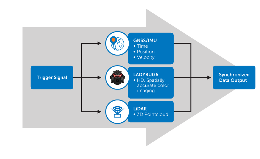
That’s where triggering comes in. Whether you’re using a Distance Measurement Instrument (DMI) or another external signal, your camera needs to respond with precise, repeatable timing. This ensures consistent spacing between frames and tight alignment with LiDAR, GNSS, and IMU data.
More importantly, it reduces time in post. A system that captures smarter is a system that processes faster.
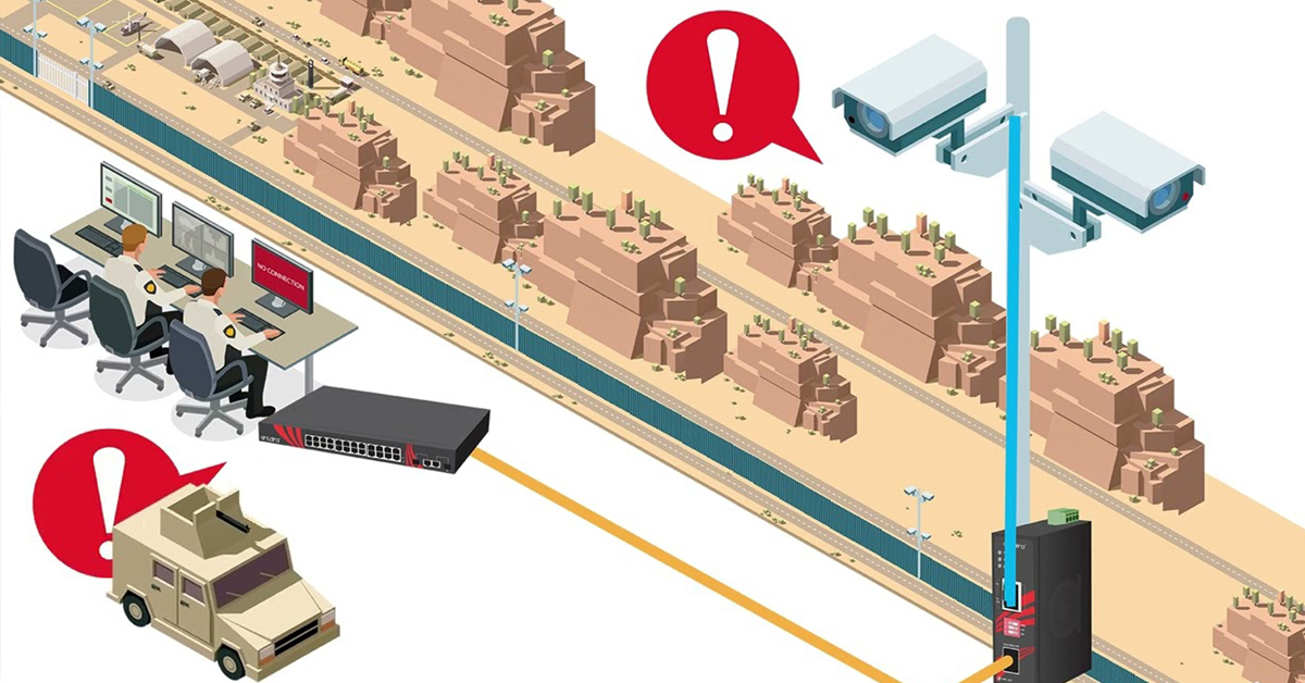
Even if your images are sharp and your timing is dialed in, they won’t matter much if your camera can’t survive real-world conditions.
Field-ready matters more than you think
Plenty of imaging systems look great on paper until they hit the road.
Shock, vibration, rain, heat, and dust are part of the job in mobile mapping. Your camera system must handle it all without losing calibration or degrading performance. Reliability isn’t just a spec—it’s what keeps your project moving.
When you’re planning a multi-day survey run or restricted time field deployments, you need to trust that your imaging system won’t be the weak link.
What we recommend asking before choosing a camera system
Here’s what we suggest teams ask when evaluating cameras for mobile mapping:
- Does the image quality hold up for everything you and your tools need to see?
- Is distortion already handled or are we fixing it in post?
- Can we trigger it cleanly from DMI, or whatever timing we need?
- Has it been run in the field or just on paper?
- If we buy five of these, will they all behave the same?
If you can’t answer “yes” to all five, it’s worth asking why.
Blog Posts
Thermal Camera Selection
How Far Can I See?

How Should Human Temperature Be Measured?

What is Wide Dynamic Range?

MYNOISE AUDIO MIXER REVIEW

WHAT IS A WIRELESS DISTRIBUTION SYSTEM?

POE VS. POE+ VS. POE++: CHOOSING THE RIGHT INDUSTRIAL ETHERNET SWITCH FOR YOU
INDUSTRY-LEADING INDUSTRIAL ETHERNET SWITCHES

UNDERSTANDING WHAT THE INDUSTRIAL INTERNET OF THINGS IS

THE DIFFERENCE BETWEEN A HUB, SWITCH, & ROUTER
5 Benefits of Thermal Imaging Cameras

DIFFERENCE BETWEEN INDUSTRIAL ETHERNET AND REGULAR ETHERNET

INDUSTRIAL NETWORKING EQUIPMENT USED FOR AUTONOMOUS VEHICLES

CYBERSECURITY: PROTECTING INDUSTRIAL CONTROL SYSTEMS

HOW INDUSTRIAL NETWORKING CAN PROVIDE SECURITY FROM DRONES
.webp)
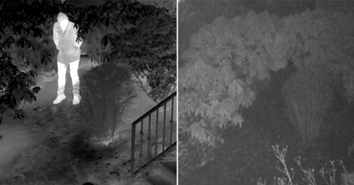
Thermal Cameras Reveal How to Keep Your Home Cool During a Heat Wave

FLıR ONE PRO
.png)
Unmatched Maritime Awareness with Cooled Thermal Imaging
.png)
What Is the Right Handheld Thermal Camera for You?
.png)
Camera Resolution and Range
.png)
Special Applications for Marine Cameras
.png)
What’s The Difference between Thermal Imaging and Night Vision?
.png)
Can Thermal Imaging See Through Fog and Rain?
Which Cx-Series Camera Is Right for You?
.png)
What is MSX®?
Five Reasons Maritime First Responders Need Thermal Imaging
.png)
3 Distinguishing Features of Superior Thermal Cameras
.png)
Determine Which Visible and Thermal Security Cameras You Need
Bullet vs. PTZ vs. Dome: Which Security Camera Is Right for You?

Interfaces for Machine Vision

Machine Vision Sensor Review
.png)
Teledyne FLIR, the Industry Leader, Launches Boson +, a Long-Wave Infrared Thermal Imager Module with an Accuracy of Less Than 20 mK
.png)
Whitepaper: IP-Based Security Convergence
.png)
3 Technologies Transforming Safe Cities into Smart Cities
.png)
Insights from the Field: Ensuring Workplace Safety Using Thermal Camera Screening for Entry Control

Thermal Night Vision as a Force Multiplier

Can Thermal Imaging See Through Walls? And Other Common Questions
Application Spotlight: Early Fire Detection for Rapid Heat Generation

Protect Personnel and Equipment by Detecting Early Signs of Fire
Teledyne FLIR Launches A500f/A700f Cameras for Fire Detection and Condition Monitoring
Thermal Imaging Cameras Help Guarantee Fire Safety in Tunnels
Thermal Imaging Cameras Help to Prevent Fires

ITS-Series Dual AID Surpasses Standards for Fire Detection Systems in Japan
How Layering Multispectral PTZ Cameras and Radars Improve Perimeter Protection
POWER REMOTE RESET TECHNOLOGY - PRRT

Why Yacht Owners are Adding Thermal Imaging Cameras to Minimise the Risk of Lithium-Ion Battery Fires?
.png)
Intelligent Transportation Systems

Best Practices Guide for Perimeter Security Applications

Protect Pedestrians, Bicyclists and More with Thermal Smart Sensors
White Paper: Application of Ground-Based Security Radar to Perimeter Systems

What is Thermal Leakage and How to Reduce Its Risks
Battery Inspection Using Advanced Thermography

Providing ire Protection for Lithium Battery Storage
The Power of Thermal Imaging
.png)
Why Panel PCs Are Perfect For Industrial Applications?

Teledyne DALSA
.png)
Advantages of Virtual Barrier Video Analytics for Perimeter Security Systems
.png)
.png)
NASA Takes the Teledyne FLIR Boson Thermal Camera Module Out of this World
.png)
Port Security Enhancement: DP World Yarımca's Trust in FLIR Security Solutions for Effective and Safe Port Operations
.png)
The Importance of Thermal Sensitivity (NETD) for Detection Accuracy
.png)
Bosphorus Boat Show 2025: The Meeting Point of the Maritime World

Application Spotlight: Critical Asset Monitoring for Thermal Conditions
.png)
Thermal Imaging for Marine Firefighting
Imaging in Mobile Mapping
.png)
Using Thermal Imaging for Oil Spill Detection

Five Reasons Maritime First Responders Need Thermal Imaging
Case Study: Tackling Compressed Air Leaks in Automotive Parts Manufacturing with Acoustic Imaging
Thermal Night Vision as a Force Multiplier
.png)
Line Scan Contact Image Sensor - AxCIS
Beyond Resolution: What Really Makes a Camera System Work for Mobile Mapping
.png)
Multispectral Marine Cameras for USV Applications
.png)
Stabilizing FLIR Cameras for Smooth Viewing in Rough Waters
 (1).png)
Enhancing Maritime Safety with Video Tracking & Radar Integration

