

RAVEN Site Planning Tool
Professional security site planning software

RAVEN Site Planning Tool
Professional security site planning software
Featured Information
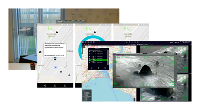
SATELITE IMAGING INTEGRATION :
Raven utilizes Google Maps satellite imagery worldwide to provide the most accurate site representation possible.
OVERLAY IMAGERY FUNCTION :
Import your future site plan into Raven and overlay it onto Google Maps before laying out your cameras.
CREATE YOUR PDF REPORT :
Create your plan, then output the PDF report complete with detailed GPS camera locations and models ready for quote building.
RAVEN Site Planning Tool
Professional security site planning software
- SATELITE IMAGING INTEGRATION : Raven utilizes Google Maps satellite imagery worldwide to provide the most accurate site representation possible.
- OVERLAY IMAGERY FUNCTION : Import your future site plan into Raven and overlay it onto Google Maps before laying out your cameras.
- CREATE YOUR PDF REPORT : Create your plan, then output the PDF report complete with detailed GPS camera locations and models ready for quote building.
RAVEN Site Planning Tool
Professional security site planning software
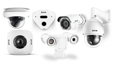
Raven is a professional site planning application that empowers planners and integrators with thermal security camera simulation and google maps layout ability. FLIR has created this industry standard application to meet the needs of its commercial and retail clients.